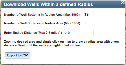
Click the Download
Wells  button in
the toolbar. The Download Wells
dialog box displays.
Download Wells
The Download Wells tool allows you to create a circle at a defined radius around a specific point on the map and export information related to the wells within that circle to a comma separated values (CSV) file.
NOTE: The Download Wells tool can export information for up to 1000 wells that within the circle.
Using the Download Wells Tool
Click the Download
Wells  button in
the toolbar. The Download Wells
dialog box displays.

In the Enter Radius Distance field, enter the radius distance in miles.
IMPORTANT: 1) To ensure optimal performance, a maximum radial (buffer) distance of 2.5 miles is allowed. If you enter a distance larger than 2.5 miles, the tool automatically changes the distance to 2.5 mile when you click in the map. 2) Depending on the distance you enter, you may have to zoom in to select a point.
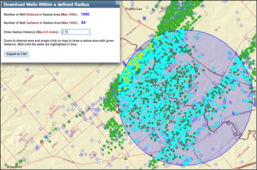
In the map, click the location to draw the circle. The specified radius displays around the point, and the wells in the circle are selected.
NOTE: The Download Wells tool can export information for up to 1000 wells.
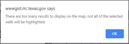
A popup window will display when the well number to be retrieved reaches 1000. Click OK and wait for the process to finish:


Click the Export to CSV button to export information for the selected wells to a CSV file.
IMPORTANT WARNING: To avoid losing leading zeros in some of the exported data, do not save the file in CSV (.csv) format. To preserve the leading zeros use the ‘save as’ and change the format to Excel Workbook (.xlsx) before saving or renaming the file.
About the Well Data
The Download Wells tool retrieves Geographic Information System (GIS) data for each well in the circular (buffer) area. In addition to the GIS information, the tool also retrieves operator/wellbore information, completion records, and plugging records when applicable to the wells.
The most recent on file operator/wellbore and, if applicable, plugging record information for each well is exported to the CSV file.
All completion records are retrieved for each of the wells. Each completion record has its own row in the CSV file which also contains the most recent operator/wellbore information and, if applicable, plugging record.
DISCLAIMER:
A “data set” is any set of information electronically generated
or stored by Railroad Commission of Texas (Commission) systems, including,
but not limited to, the Commission’s Geographic Information System, Online
Research Query System, or Mainframe System.
The
data sets contained in the Public GIS Viewers were generated from the
Commission’s Geographic Information System. These data sets are provided
as a public service for informational purposes only. They are not
intended to be used as an authoritative public record for any geographic
location and have no legal force or effect. Organizations and individual
users are responsible for verifying the accuracy, completeness, currency,
and/or suitability of these data sets themselves.
The Commission specifically disclaims any and all warranties, representations, or endorsements, express or implied, with regard to these data sets, including, but not limited to, the warranties of merchantability, fitness for a particular purpose, or non-infringement of privately owned rights.